02 January 2014


A NEW TRIP – Nov 2013.


2 Jan 2014    Brisbane Qld.


Finally, Yep! Finally, here’s our first post after leaving Canberra.

After many late stage “must do’s” had been either completed or substituted with an excuse, we hit the road on 1st Dec.

We now have a new tow vehicle in the form of a Landcruiser 200 series diesel, so the first week involved a reasonable amount of time understanding just what it does, how it does it, and “Why the $%^& $#$%@ hell” doesn’t it do what I want.  And, who writes the user manuals for..... well, anything? Should details about the interior lights be listed under: Interior, Lighting, Accessories, Options!, or Electrical?

Our timetable was to be in Bargara Qld by 12th December so that we could see the turtles come in and lay their eggs.    This meant we had limited options to spend time along the way so we chose to travel via every back road we could find, and stay for multiple days at only one place (Mudgee).

Day one and we tackled our first descent climb – and it turned out to be a good one. The road from Goulburn to Oberon drops down to the Abercrombie River and then climbs over 700 metres during the next 20 kilometres – but the first 400 metres of the climb is met within the initial 4 km. The new tow beast handled it with hardly a pause, but I fear that our beloved previous one would have been down to its very lower gears.

A one night stop-over (stand?) at Bathurst witnessed our 1st disagreement. Shirley wouldn’t let me try for the “Car towing a 3+ tonne van” lap record of Mt Panorama!  I just knew I could break the 10 minute mark, but was denied the chance.

The next day and another big climb as we dropped down into the historic village of Sofala, and then climbed the quite short (3km) but really very steep exit. I can’t think of a steeper bit of main or secondary road in Oz.

Mudgee is one of those places that we had been through many times, but never stopped to see what it had to offer. Our 5 days were great – day trips to old mining villages, wine tasting, local history (2nd oldest settlement west of the Blue Mountains), and wine tasting. I fear that because Shirley has once again filled the back of the Landcruiser with wine, I must suffer with the task of reducing the load. It may take some time, but I’ll keep at it.

From Mudgee, we went north via Narrabri and the Killarney Gap road to Bingara, then onto Inverell, Texas, and Toowoomba where we stopped for 2 nights. Yep, we’ve been through Toowoomba before, but never stopped – but we’ll spend longer at some future date as we really liked what we found.

Eventually we arrived on schedule at Bargara and set up camp about 6 metres from the high tide mark. Each night we’re lulled to sleep by the gentle breaking of waves upon the rocky ‘beach’, followed by a dawn spectacle of the sun shimmering across the sea. And, from time to time we were treated to a mid morning performance by a pod of dolphins.    
Life can be hard sometimes
Mid to late every November Loggerhead turtles begin their egg laying at a number of Queensland beaches. Mon Repos beach is where Qld National Parks have established a research and conservation centre, with visitor facilities and each night they run guided viewing.

We went there on two nights and were able to see the nest digging, followed by very close look at   the actual egg laying – average 125 to 130 eggs per clutch!, and each female comes ashore 3 to 4 times at 2 week intervals!!!!!  

The laying area is in the upper beach and dunes but earlier this year the beach was seriously depleted by a cyclone. The turtles now have great difficulty accessing the area that is above the summer high tide line so the rangers wait until ‘mum’ returns to the sea before digging up the eggs and transplanting them further up the dunes. This allows the viewing group, particularly kids, to experience a very rare and special moment as they are encouraged to help carry the eggs to the new nest.
Another turtle saved.
 After a week by the sea, we moved off and headed to Brisbane, where we we’ll stay with family until just after New Year.

Not much to say about our Brisbane stay. went to the movies; went out to dinner; visited friends and family; and ate far more chocolate that some might suggest was in out best health interests! The really big thing was to just spend time with some of our family who live far from our previous home - sometimes its perfect to just be there and chat.

We move up to Warwick on Sunday and the forecast is for 40 degrees (oh! Bugger, hope the air con can handle it).

25 November 2013

November 2013 - leaving home

Well, we have done it,  sold our house and we will live in the van until we find a new one.  We moved out on 11 November and stayed in the van at Mathew's house for a couple of days, then moved over to EPIC (Canberra's showground).

We have set up the van, although the aerial is not too good and we can't get ABC at all.  Horror horror.  Ian has bought a new aerial but needs some bits to install it which are proving to be elusive.   When we first moved to EPIC we had to get an electrician to come and install a new water heater element as ours was tripping out the electricity.

We had family dinner with the kids at the Southern Cross Club, and caught up with their news, including Grace who has just returned from overseas.

It is taking some time to get used to the bed in the van, Ian's feet are hanging out the end again.   We are also having trouble remembering where things are or should be.  Remember, Ian can walk from one end of this house to the other in 4 steps so there is not many places for things to get lost. not. 

Ian will update the blog as we go along, so keep an eye out.  We expect to leave Canberra on 1 December and head north.

14 November 2012

14th November 2012, Summary

As promised, some data and general info from our trip.......
Firstly, our rig consisted of a Turbo Diesel Toyota Landcruiser 100 series, towing a semi off-road van which is 22ft long and weighs 3.2 tonne when fully loaded. I’m fairly confident that we didn’t get too close to that figure as we generally didn’t have the water tanks full – that saved 250 kg. If we intended to ‘Bush Camp’ we filled the tanks, but elsewhere we only carried about 40 to 50 litres. As we left home we deliberately ran light to allow room in our payload to buy stuff as we got into the trip (Shirl has the capacity to spend like you wouldn’t believe – I only drink the wine so that we can lower our rig weight).
Typical cruising speed was about 85 kph, but out on the flat plains, it crept up about 10%. If into a headwind, we dropped back to about 80 kph.
Daily travel distance varied a fair bit – eg: maximum daily this trip was 422 km, with only another 5 days being greater than 400km. Minimum was 36 km, but that was because of our blown radiator. The minimum normal day was 106 km, with another 6 days being less than 150 km.
We travelled 16,054 km with the van, plus another 7730 without the van.
Total fuel used was 4632 litres, at an average of 19.48 litres per 100km. Cost of this fuel was $7,454 (dearest = 202.9 cents/litre). And, joy oh! Joy, our precious fuel vouchers saved us 1.41% or $106.27. Fair dinkum, if any other business offered you a 1.4% discount you’d laugh at ‘em.
We were away for 218 nights, and we stopped at 59 different locations. The most expensive nights were at Parklea in Sydney ($52.50) and the cheapest night was $19 at Dunmurra in the Northern Territory. Overall we averaged $31.29 per night when using Caravan Parks. It shouldn't be a surprise that the six most expensive places (over $40) were at the "Big Ticket" places such as Broome, Kakadu, Exmouth, Bungle Bungles etc.
During the last year (since Nov 2011) we have dragged the van through each and every mainland capital city. We have also driven on (but not always with the van) the most easterly, northerly, and westerly piece of sealed road in the nation – we also came real close (42 km away) from the most southerly.
Between Byron Bay (18th Apr) and Perth (31 Aug), we didn’t see any rain – nor did we find the need to not wear shorts nor put a jacket on.
Specific memories include the excitement of departing, and the joy of returning. The bits in between were also very very special. Of course, some places were more special than others, but we don't recall any bad places.
At this moment, we are not planning any long trip next year – we may hitch the van up sometime around next Spring/Summer for a short 3 or 4 weeks.
Cheers to all.
We're travellin' before unravellin'

07 November 2012

7th November 2012 – End of Trip.

This will be our final post for this year (Oh, sadness shall overcome us). So after some notes about the last portion of our trip, I’ll do another post with a summary of the year – everyone happy with that?
The area of South Australia that sits just to the north of Adelaide is so good it should be listed as a National Treasure. The rolling hills are just so bloody picture perfect, and the villages and towns are just what you’d like to think a village should look like. If you want some history, this area has it to spare –  ‘frinstance, everybody’s heard of the famous “I shall return” speech by General Douglas McArthur in March 1942, well it was made at the tiny little village of Terowie.  Likewise, the very first serving Federal politician to be killed was Percy Brookfield, Member for Broken Hill. He was returning home from Adelaide and when the train stopped at Riverton, just south of Clare, a bloke started shooting and Percy was killed while trying to stop him.
Kapunda (this one is a real jewel) was the home and business centre of Sir Sidney Kidman, at one time the World’s largest landowner. Kapunda is also the site of:  Australia’s first Mining Town, and Australia’s first open cut mine. Wow!  but wait, there’s more. Kapunda has supplied more state Premiers than any other Aussie town, and also was the birthplace of 30 members of parliament – have you had enough yet?
Outskirts of Clare - Martindale Hall stately home - used in the movie "Picnic @ Hanging Rock".

So, apart from history what does this region have? Wine, wine, and more wine. Clare valley is home to some of our best known brands, plus has ‘outposts’ of numerous others who seek the rich local Riesling grounds. We tried, really tried very hard to taste all the cellar door offerings, but we ran out of time. The Landcruiser now had a strong sag in the rear because of our few little samples that we brought home (purely so that we could continue our test tasting in the interests of scientific analysis).
We were quite besotted with the area and would return again in the blink of an eye.
As we headed across to Mildura, we paused at the historic mining town of Burra where the discovery of copper in 1842 saved the colony of South Australia from bankruptcy.  We also had a brief stop at Morgan, which was once the busiest port on the Murray but these days has retreated into a quiet holiday centre of houseboats and paddle wheel tours.
 Houseboat Heaven at Morgan on the Murray
The river ferry has been operating for over 160 years

Mildura! What a magic city. The main street is Australia’s longest Avenue (12.1 km) but it isn’t the length that catches your eye – it’s the trees, shrubs, and flowers that adorn the entire length (mainly it’s the trees). Our caravan Park was right on the river where we could just sit and watch the world float by. It was really good to have a few days of simple relaxation and recharge ourselves (wine tasting at Clare Valley wasn’t easy work, let me tell you).

Donald, Daisy and their kids visited our site at Mildura

Now it’s time for some mental arithmetic: I want you to imagine an area 23 km long - - - - - okay, got that? Now imagine that area is 12 km wide.  That’s the total size of the Bendigo gold fields, and it had 5,600 mines!  Think about just how crowded it must’ve been. Now think about the underground tunnels with all those mines. How come they didn’t run into each other?  Over 6,000 km of tunnels still remain under the city, with the deepest at 1400 metres. We went underground to just over 60 metres, and that was really interesting, but the thought of 1400 metres is quite scary.   
Bendigo has to be one of the most impressive architectural Aussie cities as it has retained most of its old public buildings from the late 1800s and early 1900s – that includes the Shamrock Hotel which is surely one of the best looking and grandest pubs in the country. The main street would have to be one of the most impressive in the country.
 St Aidans Orphanage - Magnificent old building recently converted to apartments, and the extensive grounds an upmarket housing estate. 
 60 metres down at the coal  GOLD face
World's oldest Chinese Dragon, plus the World's longest one. The head is lower centre of photo, and curls around and upward behind photographer, to end on top level. 

After Bendigo we had to go to Melbourne to have some warranty work on the van, so that left us with a day of nought to do – we took some time to go and see the two towns that were devastated by Bushfires in Feb 2009. Firstly, it must be noted that the drive from Healesville to Marysville is very very impressive – the Alpine Ash tree forests that you drive through are without a doubt some of the tallest, not only in Australia but the World.

To get to either Marysville or Kinglake requires a 500 metre high climb as they both sit atop mountains.  To see just what damage the fires did was quite an eye opener as large sections of the forests still show significant sections that haven’t fully regrown. However, the towns are where your senses come in for some deep breaths. At the Marysville info office, a map is available that shows the current status of each house and business as they rebuild. The most revealing thing to me was the number of buildings that were burned – almost the entire town.
Kinglake is quite some distance away by road, but much shorter via the treetops – the fire took the shorter route. Again, most homes are either new or under rebuild. And once more the devastation was quite mind numbing.
 One of many such Rhodordendrum  Rhoderdendrom really awesome shrubs and bush adorned properties on the road to Kinglake.
 Some seriously tall trees on the road to Marysville - like this for kilometre after kilometre.
 A really unusual statue at Marysville
Marysville housing area - was full of houses, now slowly coming back.

After we had our van sorted out, we travelled home via Shepparton so that we could stock up at the SPC and Campbell Soup factory outlets (up to 70% discounts),  and then a quick one night stop at Gundagai.
It's hard to believe that until the early 80's this bridge (nearly a kilometre long) was a part of our busiest highway (Hume Highway at Gundagai)


Arrived home on Saturday 3rd and it’s really good to be here – we had a great time, with so many awe inspiring sights, but there’s no place like home.         

16 October 2012

16th October 2012 – Whyalla.

Well, we made it. We have conquered the Nullarbor. But, to be absolutely pedantic, the Eyre Highway only traverses about 20 to 40 km of the true Nullarbor. The majority of the Eyre is just to the south of the treeless plain, but the journey remains as one of the great drives of the World. From Norseman to Ceduna is approx 1200 km and during the drive you will pass through one true town (Penong), plus Eucla which is listed as a town, but really only qualifies as a slightly elaborate roadhouse. The remaining 6 named locations are roadhouses with very rudimentary caravan parks (showers, toilets, electricity and water which you cannot connect to your van). The roadhouse at Yalata has closed.

East of Balladonia

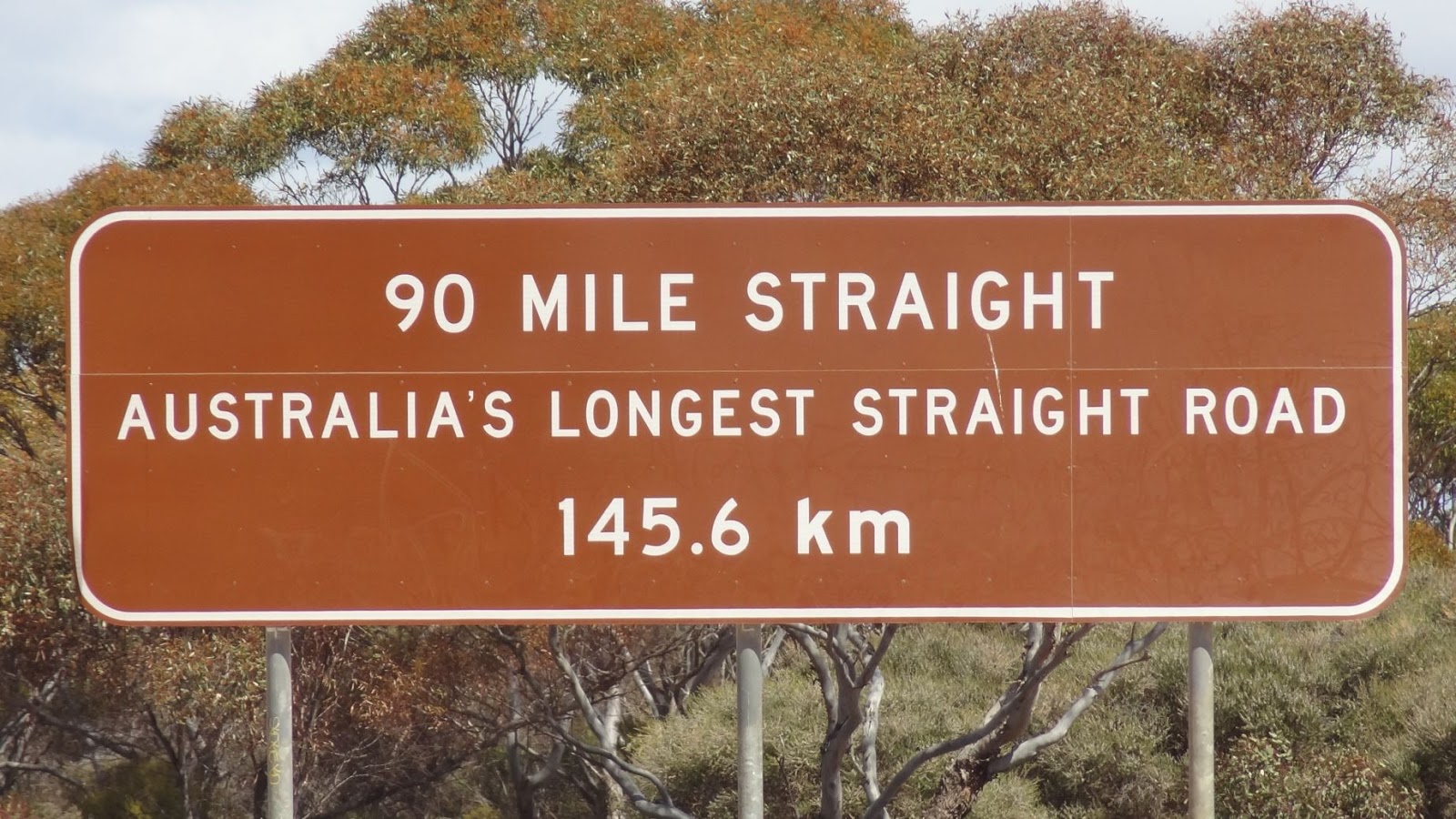
The majority of the vegetation is bluebush as an understory of eucalypt mulga with patches of low saltbush scrub. However the biggest visual impact is the straight sections of road – 90 Mile Straight (145.6 km) gets all the PR focus, but the entire trip is dominated by a series of other straights, many of up to 100km, and each connected by the merest slight curve. Some relief is found at Madura Pass where you drop about 180 metres to the Roe Plain, and then, after 120 km, pop back up at Eucla.
The longest of many
 A Pedestrian Xing out here?  No, a landing strip for the Flying Doctor.
 Yep, that's the ocean in the distance - from the top of Madura Pass

.
Our campsite at Moondini Bluff.

Communication is ...... no, it isn’t, it just doesn’t exist: no TV, no Radio, no Mobile, and zero Internet. Of course you can use satellite type access for some of these, but the ordinary services are nonexistent. One of the excellent trade-offs for these privations are the outstanding dark nights with the accompanying brilliant star display.
We stayed at Balladonia Roadhouse (190km), Moondini Bluff bush camp (550km), Nullarbor Roadhouse (900km), then onto Ceduna. About 45km before Nullarbor R/H we caught up with our cyclist friends who were nearing the end of their most successful day. With the aid of a great tail-wind, they did 185km in one day, and this was done with bikes heavily laden with camping equip, food, and clothing!  We all camped together at Nullarbor and shared a big hearty pot of meatballs in homemade Italian sauce on a bed of rice – those boys sure can eat!
 They arrive at Nullarbor Roadhouse
The Fairway - Dingo Den Hole 14 on the Nullarbor Links
And the Green

As you head across this iconic piece of road you regularly come across signs that alert you to some of the potential hazards. It always amuses me to wonder just how the animals know that they’re not to go past the sign – this side is okay, but not the other!
Note the animals that you might run into! (note the 3 bike riders in the distance)


 This is about 300km west


However, some of them just seem to take advantage of the warnings. We were travelling along quite happily when we spotted something up ahead and as we got closer we realised that it was a pair of kangaroos. They remained stationary in the middle of the road, until such time that we had come to a complete halt. Once they had asserted their superiority, they bounded off before Shirl got the camera out.
Perhaps they were trying to warn us of the 5 foot brown snake that was just up the road – With the van on behind, I couldn’t swerve far enough, so his trip across the road became his last.
Just to the east of Eucla you get to see your first close-up view of the sea cliffs for which the area is famous. There are a number of lookouts in fairly quick succession, and each offers truly awe inspiring views. The cliffs seem to go on forever, as I suppose they should given that they are among the World’s longest sea cliffs.
 Looking to the West
And looking to the East - note the safety fence .... not!

A further few hundred kilometres along the road is where you find the “Head of Bight” which is the most northern part of the bight. It is here that each year hundreds of whales come to calve, and then remain while their new babies grow and build strength for the return to the Antarctic. We arrived at the very end of the season, but were rewarded with a mother and calf frolicking just below the lookout, plus another single adult about 100 metres off the cliffs.
 The "True" piece of the Nullarbor Plain (just east of Nullarbor Roadhouse)
Mum and Baby of Head of Bight. (it's hard getting a good photo - they don't send you an email to say they're about to breach)

Not long after we passed Yalata we came across a cattle grid in the road. This was the southern end of that great Aussie dog fence which runs for 5614 km from the bight, through South Australia, NSW and Queensland. Built in the 1880s it is the World’s longest fence, and also one of the largest structures.
Ceduna marks the accepted end of the crossing and we arrived to find that, to our delight, the annual oyster festival was underway – Ah, let me think of how many ways that I can eat an oyster! Just as Ceduna is the end of the Nullarbor, it is also the start of the Eyre Peninsula which can be split into two clear areas of focus – the southern coast is very much a series of fishing towns: each one a gem. Inland from the coast is wheat growing country: and a lot of wheat there is. To support this enormous grain growing, there appears a seemingly endless supply of large silos and grain loading jetties. Our route took us along the south coast with a 4 day stop at Streaky Bay where we set up right on a beach. However, our site had ground so hard that we couldn’t drive any pegs into it even when we resorted to trying to drill a hole with an electric drill. Our solution was to grab a couple of very large rocks and tie the awning ropes to them.

View near Streaky Bay
Oyster Festivities at Ceduna

Our 2nd evening and a knock on our door revealed that our intrepid cyclists had found us. This presented a small problem in that there’s a limit to how many rocks you can use to tie down 3 tents.
The local info centre has a somewhat unusual display in the form of a replica of a 5 metre White Pointer Shark which was caught off the local coast. Over 1500 kilos, and caught on a 24 kilo breaking strain line, by a bloke who was fishing for snapper! I bet he had a job to fillet it.

I think they're waiting for some Shark Fillets
 Murphy's Haystacks - east of Streaky Bay
I spy you, Ya can't hide from me.

Once we got to the tip of the peninsular at Port Lincoln, we found that we had also found the peak of the wind – we got tired putting the awning up each morning (very little wind), and then dropping it each night. This seemingly pointless exercise was necessary because, you guessed it, the cycle guys had caught up to us once more so we again had campsite guests. The weather on the day that they left was very strong winds plus rain, so at first it seemed silly for them to go. We heard from them that evening and they had had one of their best days so far – marvellous what a strong tailwind can do for your average speed.
 Taken from the front of our van - Port Lincoln
Statue of 3 x Melbourne Cup winner - Makybe Diva. Owned by Port Lincoln Tuna Boat owner.

I’m not sure that many people know that the underwater shark scenes from the “Jaws” movie were shot around Port Lincoln: True. If anyone would like to replicate those scenes, you can do a shark cage dive where they guarantee real deal white pointer(s) will come along and try and eat you. Only $400. If you don’t like that, perhaps a dive with friendly sea lions is more to your taste.

We are now at Clare in the epinonomous wine valley. After Port Lincoln, we stopped at Arno Bay to catch up with a former workmate whom I hadn’t seen for 25 years. We spent a lot of time reminiscing and recalling both old colleagues, and funny happenings – interesting to think that some of these ‘moments’ were maybe not thought of as significant at the time, but since they are the ones we’re recalling many years later they must’ve had some impact on us!
Whyalla from Hummock Hill - The entire beach disappears at high tide

We also stopped at Whyalla so I could have some physio, and while there we did a quick drive around. Clearly the steel works are the big thing for the town, but the snapper fishing is also a large component of Whyalla’s economy.
We have decided to give Adelaide a miss as we were there last year. So now we’ll go via Burra to Mildura where we’ll stay for 4 or 5 nights before pushing down to Bendigo. After a brief visit to Melbourne to get some warranty work done on the van, we hope to be home very early November.
I’ll post another update perhaps from Bendigo or Melbourne.


24 September 2012

25th September, Kalgoorlie


Having just spent nearly three weeks travelling across the southern portion of Western Australia, we are totally entranced by the glorious beauty of it. Admittedly, it is dominated by seaside views, and that whenever they exist, it is taken for granted that they will look really good. However, these seaside views are outstanding. From the colour of the water, thru the rugged cliffs, to the numerous islands the areas ability to extract moments of awe from you is never ending.
As we had explored the Bunbury, Busselton, and Margaret River areas a few years ago, we went directly from Perth to Albany, and yes, the route was ‘wildflower nirvana’ – everywhere is!
Albany has many more really big hills than we had imagined – everywhere you go it seems to be up or down, with even the main street being a quite descent hill. This idea of going “Up” allows me to raise the issue of town names down here in the south. A good number of towns end in “up” – Dwellingup, Amelup, Burngup, Pingrup, Ongerup, Boyup, Burekup, Cowaramup, Manjimup, Quinniup, and I suspect that if we travelled wide and far enough we'd find a Stuffup. It was so bad that when we were looking at a grain lift, we expected the control buttons to be marked as “Up Up” and “Down Up”.
 Panorama of Albany.
 King Sound from the beach
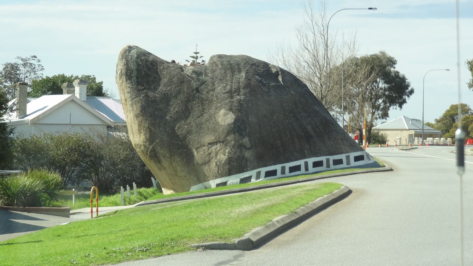
Dog Rock within the town.

Way back in the early 1950s a whaling station was established at Albany, and it continued until 1976 when it closed as Australia’s last such place. These days they run a really good tourist facility with most of the original plant still in place. It is quite an eye opener to do the tour and learn just how brutal, and how smelly, and how tough the labour was to harvest the oil, meat, and baleen. Such was the volume of blood and guts that ran down into the sea from the slaughter slipway, huge numbers of sharks congregated in the small adjoining bay. The numbers were so great that men in small boats were sent among them to kill them by use of rifles! They also have a real whale chaser ship up on a slipway so that you can climb aboard and wander around. I certainly wouldn’t want to live on one – the rooms and facilities make a caravan look like a palace.
 Skeleton of a Blue Whale - all 72 feet of it.
 Harpoon gun on bow of Whale Chaser boat.
Engine Room - they only employed short guys.

 We did a day trip to Denmark - this is the local river.
And again

As we moved on towards Esperance, we deviated to Hyden to see the famous Wave Rock. It was good to see it in real life (as opposed to photos), as it is larger than expected, and that it’s a relatively small part of a huge rock ridge that extends to cover a vast area.
 Beside the road to Hyden - bloody wildflowers everywhere.
 Okay, I'm lookin at it.
 I'll try swimming up it....
 Hey, this is great. Ya don't get wet if you fall off your board.
Another rocky feature - Hippo's Yawn.
Our next stop was at Ravensthorpe where our little deviation ended as we got back onto the Esperance route. While there we popped in to see the annual Ravensthorpe Wildflower show and were duly stunned by the enormous range, variety and number of flowers on display. No longer as we drive along at 85kph will we assume that all the yellow flowers consist of three or four plants. We now know that just within the Ravensthorpe alone, area there are at least 30 to 50 different yellow plants! Plus a similar number of red/orange/plum coloured types. Astounding: but we are becoming a bit “Wildflowered out”.
 Ravensthorpe Wildflower display
There's more than one Yellow out there!

 I’m sure that everyone has seen photos of wild kangaroos lying on the vivid white sands of Lucky Bay at Cape Le Grand National Park. Well, it isn’t a simple distortion of facts, nor even a bit of spin – we day tripped from Esperance and were quite taken while walking hand in hand along the squeaky white sand (ain’t love grand?) to see Kangaroos hop out onto the beach and munch on the seaweed that had washed up. This activity was clearly strenuous as once they had eaten, they needed to lay and rest awhile. Winter storms have created quite a bit of beach seaweed and thus the ‘roos have a smorgasbord of fodder. Note the larger roo in the photo – she is carrying a Joey in her pouch.


Lucky Bay - 60km east of Esperance in Cape Le Grand Nat Park
 
Reputed to be the whitest beach in Australia.
 It's very Kangaroo friendly
 Dead seaweed washed up during winter storms.

Other beaches within the park are just as breathtaking, eg: Thistle and Hellfire beaches with water that is just soooooo blue. However, the coves and bays to the west of the town are also drop dead gorgeous too. I could live here (but not in winter).

 Hellfire Bay - also at Cape Le Grand
 Looking out to sea from Hellfire Bay
Twilight Bay - 5 km West of Esperance

Our caravan park was right on the beach and as we stepped from the van we looked out over the beach and bluuuuuue water to the archipelago. Clearly we aren’t the only ones who like the area, as living below the very long “Tanker Jetty” is Sammy the sea lion – a resident for over 15 years. It seems that he is not silly because he often swims out to the end of the jetty where the majority of fisher folk are, and as they throw the undersized or unwanted fish back, Sammy comes zooming from under the jetty to get a cheap feed. However, a chat to some of these folk reveals that none of them recall him ever taking a fish that was still on the hook – smart guy, eh?
 Squid - like most jetties, one of the more regular catches (Sammy prefers fish)
 Come on, chuck me a fish, you won't eat all them anyway.
 What a hard day I've had.
The Esperance Tanker Jetty taken from the far end.

After a week in this blue heaven, we left the coast, heading inland to Kalgoorlie-Boulder (Yep, that’s the correct name of this city of 38,000 people). At about the half-way mark is the rough and ready town of Norseman where we decided to swing into the town proper to have a look. Much to our surprise we found our intrepid cyclists (see previous posts) who had (a) lost one of their original members, (b) picked up two others. During a chat and laugh we found that they were staying there overnight, then starting the Nullarbor and after some quick calculations, agreed that we will most likely catch them somewhere around the SA/WA border.
 The round-a-bout at the main intersection of Norseman
And we stopped here for lunch - great place names they have here.

The cyclist’s timetable will be slowed a bit because they are playing the “Nullarbor Link” which is the longest golf course in the World at 1365 km. The course starts at Kalgoorlie, where each of the two local clubs has a designated hole, and then each town along the way has a hole. However, there are not enough golf courses between Kalgoorlie and Ceduna to offer 18 holes, so they have made a few extra holes at the roadhouses. It is these that provide the real fun as they are but an artificial turf (or oiled dirt, thus a 'black') Tee and putting area joined by whatever nature has created – one fairway is all sand, the next saltbush, and another rocky gibbers. Hazards are also whatever nature offers – at the Mundrabilla hole, local crows steal the balls (about 200 per year). So, I guess you’re wondering what you do about a set of golf clubs if you are not a regular golfer? Not a worry as at either end (Kalgoorlie or Ceduna) an array of used – make that very used clubs can be bought for $5. Our intrepid cyclists are doing the course armed with a putter and a 7 iron. And they are expecting to do it under par of 72!!!!!!
We are now in Kal (as the locals call it) and love all the old buildings. Originally there were two different towns – Kalgoorlie and Boulder, but about twenty years ago they decided to formally merge into a single city. The government called for nominations for a new name under which the city would jointly march forward, and the winner was ...... Kalgoorlie-Boulder.  They may be weak on coming up with a name, but their grip on heritage is very strong. All the old shops have signs above the verandas identifying what the shops original function or purpose.

We were also so impressed by the very big hole that they have dug on the edge of town that we did a tour of it. We now know what an ant feels like among a World of humans, as we travelled in a standard 50 seat coach among some of the largest trucks on the planet. They carry over 225 tonne of ore, and use 140 litres of diesel each time they climb out of the pit and then return: lucky that they hold 3800 litres in the fuel tank! Should you ever feel the need to complain about the cost of your car tyres or service charges, consider that the tyres for these monsters are $40,000, and a service is in the vicinity of $2,500,000?  The ‘super Pit’ is 3.5 km long and 1.5 km wide and has a depth of 360 metres. 28 tonnes of gold per year are recovered from the 15 million tonnes of ore that they dig out. Everything about this hole is really really big.
Note the guy standing near the front wheel.

Driving around this site can be dangerous
It's deep, make that real deep.
Those big trucks look like matchbox toys
Look at the line of big trucks crawling up from the pit - it goes on like that 24/7.
One of the interesting oddities of Kal, is that the city is home to Australia’s oldest continually operating legal brothel! And, they run tours of it!! (I understand that they don’t offer any free samples or titbits).
 From across the road (Shirl wouldn't let me get closer)
I really didn't go up too close - I used a zoom lens.

On a similar focus, the magnificent old pubs have for many decades had female bar staff dressed (if that be the best word) in attire known as ‘skimpies’, and that for a suitable tip or donation they will reduce the level of clothing. Shirl won’t let me go for a beer.


Tomorrow we leave to cross the Nullarbor, so we will have very sporadic TV, Internet, and phone coverage for some 1365 km (until we get beyond Ceduna). Our expectation is that we will hit Ceduna around the beginning of October.