06 August 2012

6th August 2012 – Carnarvon.

Yes, I know I said I'd do the next post from Exmouth. I lied, okay?
Our original plan was to head into Karinjini for a few days, then exit back to the coastal highway at Nanutarra, however reports of crowded campsites, plus big deep gorges that needed to be walked (climbed?) we decided to go straight down the coast road to Point Samson. Bugger, it was booked out solid for weeks, so we went to Roebourne.
One of the first towns up this way, Roebourne was once the hub of all that happened in the Pilbara region. These days it is displaying the final gasps of a dying town with almost nothing left but a fuel outlet, some Aboriginal artwork museums, and a hospital.
Upon arrival at our designated site, the fellow opposite came over and advised that “You’ll have problems gettin’ in there, mate”. He continued, “Too tight and too skinny”. He then said that the only way he was able to get his van in was to make use of the vacant site that we were about to use. I noted his van was a few feet shorter than ours, so maybe it would be tight.
Shirl took up her position; I moved forward under her control, selected reverse and we popped it in perfectly, first go. Our new friend came over and said “That was bloody impressive”. So, I guess we can now say that we have sorted out a procedure that works – truth is we’ve been reversing it perfectly into sites for this entire trip. Indeed, it shocks us now if we don’t get it spot on first go.
After settling in, I began climbing in under the sink to fix the ‘solar/battery smart charger’ where it’s mounting had come loose. Having finished, I exited the contortionist position that I had assumed and immediately felt severe pain in the lower back. I, like most men, stoically accepted it and said to Shirl that “She’ll be right, I’ll just sit down for a while and all will be good” (truth, I bitched and cursed and sought Shirl’s sympathy).  After some other symptoms developed in the lower body, we decided that a trip to the local hospital was needed. Result: the work under the sink simply confused the issue because after a quick test it was decided that I had a kidney stone – bugger. The pain was immense and intense and I found that the foetal position was quite reasonable. When I first arrived at the hospital, the nurse had asked “At its worst, how would you rate the pain out of 10”. I replied “maybe an 8 or 9”. “Oh, not a 10” says the lovely lady. My response was pure macho, he man – “No matter how it is, it can always get worse, so it can’t get to 10”.  Lovely Nurse left the room, and when she returned I was stretched sideways across the table, tears forming, voicing the most profane curses. This bitch now asked, so sweetly, “How would you rate the pain now?”  "It’s a bloody 11, and who do I have to kill to make it go away?”  
Panodol Forte, plus a 90 km round trip to Karatha hospital the next day for tests plus a cat scan revealed I had passed it and was now okay. However, there is another teeny wheeny one developing in the other kidney.
Given that we had to wait some time for the results of the tests, we took the opportunity to pop out to Dampier and have a look. This town is but 20 km from Karratha and is where the Ore Loader is to be found. Dampier is also the location of Australia’s wealthiest people (based on averages). We expected to find mansions, yachts, Ferraris and other such expressions of great success, but what we found was something bordering upon a lower, make that lower lower middle class. The shopping centre was a total joke with all but the lowest stocked IGA supermarket – ‘supermarket’ it didn’t even rate as a below average market. Why? Well, for statistical purposes, the town is the home of many fly in fly out (FIFO) workers, plus those who have chosen to live there while working on the Ore Loader. The wonderful world of statistics!
Dampier Ore Loader - not quite the up market town expected.
We also noted that Karratha has, as everywhere in the tropics, an abundance of steel framed, aluminium clad homes. Given the huge quantity of termite mounds, we think that these may be the reason, however it does look odd to see very large McMansions built with corrugated metal!
Once my little medical drama was sorted, we took the time to explore the coastal area around Roebourne. Cossack is now totally deserted but many of the old stone buildings remain and are in remarkable good condition.
Cossack Beach - a deserted beach for a deserted town

 However, at Point Samson (which was our original choice to stay), the town has no great remnants of its history, and has evolved into a holiday village but without any shops! If you want something, go to the caravan park office – if they don’t stock it, go to Wickham (15 km), or if your needs are greater, Karratha (50 km).
The front of the Wickham Supermarket - I'm not sure Woolies have their priorities right!


As we drove toward Point Samson, we noted an entry, accompanied by numerous signs warning of “NO ENTRY” or “KEEP OUT” etc, at the Cape Lambert ore loading facility. We had never heard of it so we did what everyone does and Googled it. Wow, it has Australia’s highest jetty which juts out nearly 3 km into the sea, and holds pretty well all the records for loading ore – most per day or month or whatever, most ships loaded per whatever, and it loads 40% of the Pilbara ore!  Why don’t we hear about this place as we do for Port Hedland and Dampier?
 Next place for us was Onslow which is 80km off the highway, but right on the coast. And what appears to be a standard day travel, we met up with the intrepid bike riders again. This time they were 40km short of Nanutarra Roadhouse.
Onslow’s history was founded as many towns up here, upon the pearl and salt industries. The former has ceased, but the latter is going at full steam ahead.
Onslow Salt Jetty


A new industry has landed at Onslow’s shoreline because of it’s proximity to the off-shore gas fields (Montebello and Barrow islands). The area has thus attracted the interest of the big gas producers who are building Australia’s largest gas plant. The gas will be piped ashore, stored then shipped to ????? wherever, or piped onwards within Oz. This has created a real estate boom, with the pub, a typical 2 level Aussie thing being bought for $450K in 2005, now due for auction with a reserve of $5,000,000.
The Beadon Pub @ Onslow - but is it worth $5 Million?


Like every caravan park we’ve been to, the two at Onslow were filled to capacity and beyond. We ended up sort of sharing a small site, plus 1/3 of the adjoining one! Most park guests were there for the fishing with boats of all sizes spread around the town.
Fishing from an 'Air Boat' - goes rather well.


 There didn’t seem to be much thought about throwing a line in from the shore.
Ningaloo. What an amazing place; 150km (or near enough) of beaches and coral reef. Note that it isn’t a single long beach, but many smaller ones from a few hundred metres to a few km long. Some of those within the Cape Range National Park have official campsites which are packed solid and with a daily line up of those hoping (in vain) to get in.
The only town on the Cape Range peninsula is Exmouth, and if you’d been here prior to the late 1960’s, even that wasn’t here. The original purpose of the town was to service those working at the (then) new joint Australia – USA naval communications facility – if it’s owned by either of the 2 navies, and it floats, and it is anywhere west of Australia, then all radio traffic goes via this place.

These days Exmouth’s role is all about tourists and retirees who are into diving or deep sea fishing. Yes, they have the ubiquitous canal estate that seems to be a requirement for any seaside town. The only difference here is that the houses are built with metal frames and aluminium skins.


A very common sight around here

Our intrepid cyclists arrived only one day after us after riding their heavily laden touring bikes for 170 km in one day.  We arranged for them to set up camp under our awning while they took the opportunity to do some washing and general maintenance work – When Shirl discovered that they intended washing in plain water, she took over and used real laundry detergent to do their washing for them.She was duly rewarded with great glee when they got them back.
Our campsite looked a bit crowded for a few days

I took them over to the other side of the peninsula to see the reef as it is over 20 km just to get to the start, and then continues for over 70 km.
 A view of Ningaloo from Vlamingh Lighthouse
Wobiri Beach - somewhat crowded!  It's but one of a hundred or so.
Their highlight was to go swimming (1st time in Oz) on one of the hundred or so beaches that follow all the length of the Ningaloo Reef. One of the more popular ones is Turquoise Beach because of the extreme proximity of the coral – only a few metres from shore.
Turquiose Beach - the dark patches are the coral.
Note the coral - 30 metres out.

After Nick told us that he had lost 12 kilos over the last 7 weeks, we decided to take them out to a good feed.

Whilst consulting the menu it came out that Nick had never been brave enough to try an oyster, nor calamari. We are quite proud that before the night was out, he had tried both these delicacies; and enjoyed both.
The following day the cycling demons departed, and we don’t think that we will catch up to them again given our respective timetables.

One of the tourist things is to float over the coral on a glass bottomed boat. We thoroughly enjoyed the morning and attribute a lot of this pleasure to the great guide/boat skipper. His continued stream of ‘one-liners’ kept everyone in laughter, but was really a fun way to impart a lot of information about how the reef functions.

Fish so close that you wanted to reach out and touch them.

This shark is a vegetarian - he only eats vegetarians.


And a heap of Barracuda, each about 750cm to a metre long.


To sum up the 10 days that we spent here, “Bloody Great”. Beaches, beaches, and more beaches – and most were totally deserted;
Oh! What a feeling!
Next stop for us was Coral Bay which is about 150 k m from Exmouth and towards the southern end of the reef. Not so much a town as a tourist resort, Coral Bay has picture perfect beach, with coral reefs only a few metres off shore. Waves can be seen breaking over the outer reef about 600 to 800 metres away; near enough to be heard in the still of the night.
Panorama of Coral Bay

Each afternoon at 3:30pm two things happen at a particular spot on the beach; firstly, a crowd gathers, and secondly masses of quite large Spangled Emperor fish congregate.  A guide then distributes a few small pellets of fish food, firstly to the kids and then to the ‘big kids’. The photos show the result.
There are a lot of them.
and they are quite large
And they aren't scared

Apart from feeding fish, swimming, snorkelling, perving on those miniscule bikinis, and sunbaking we did little else.
PS – Shirl didn’t perve.


26 July 2012

25th July 2012 – Port Hedland.

Sorry for the long delay in posting an update, however with little or no internet access at many places, and at those that did we were focussed upon the latest updates from Le Tour, thus the blog faded into the background. We’ve come a long way, and seen so much since our last post, I am doing the update in two issues – both from Exmouth, but covering different sections.
Broome! This iconic Aussie town is a very interesting place that is laid out totally differently than I had imagined. There is the old or historical commercial centre, known as China Town and full of souvenir and general shopping places (Shirl bought a new dress), and ‘Old Town’ containing the original houses. Then there is Cable Beach – some 7 km away and facing directly onto the ocean. This area is so much newer and very different that it is almost as if it is another town. Resorts, cafes, restaurants, more cafes, bars, cafes etc dominate all else. Then there is the beach which I’m sure everyone knows is one of our more famous (indeed, world famous) stretches of sand. Immediately in front of the ‘Resort’ section is the area used by those who seek to sunbake or to just look beautiful, whilst to the north lies the section (17 km) available for 4x4’s to go fishing, or to blast up and down and generally have fun. This section is also an official “Clothing Optional” beach, thus making it the World’s longest nude beach.
The very large tidal range creates the rare phenomenon of “Stairway to the Moon”. This only occurs when there is a spring low tide at night (approx 3 nights per month) and we were lucky to be there for this special event. Town Beach is the location, and on these special nights a total night of entertainment is organised with markets, plus defined parking and police patrols all in place. The crowd is very impressive – people travel to Broome specifically to see this bit of magic. I don’t think that I have seen such an array of tripod mounted photographic equipment with lens so large that they almost needed their own tripod. Result? Worth a good trip just to see it, even if it only lasts for 15 to 20 minutes. Sorry that we haven’t a photo, but the ones that we took just didn’t quite make the grade – try google.
Yes, in case you were wondering, Shirl wandered around the markets and left with 2 really different scarves – or should that be scarfes? Anyway, she left with a scarf in one hand, and another scarf in the other hand.
If you grab a map of the area north of Broome you will find a place called Cape Leveque – pronunciation is a wee bit variable with the original French using the 2nd ‘e’ as in egg, and modern laid-back Aussie using ‘ee’ as in peek. Whichever you use, it’s a very special place.
We chose to go via an organised tour and when we were picked up at 7:10am we looked at the ‘bus’ in shock. We were to travel the 200 km to the cape in an extended wheelbase Landcruiser that held 12 passengers, and towed a fully enclose trailer – somewhat rustic to say the least. 15 km later we understood why this was the vehicle of choice – we started the 90 km of gravel; a badly corrugated 90 km (make that a very very badly corrugated). Bits of us that we didn’t even realise could wobble and jiggle did so. Throughout the 2 hours of rattle, bang, wobble, jiggle, slip, slide, and mayhem the driver/guide kept up a funny but informative chat about the area’s history and characteristics.
First stop (after we got to the bitumen section) was at Beagle Bay to see the Sacred Heart Church (google it). This was the church used in the somewhat recent movie ‘Bran Nue Dae’ starring Geoffrey Rush, and is just amazing with all the decoration being accomplished with pearl shell.


Next stop was at Cygnet Bay Pearls where we were shown the entire process of pearl production – bloody amazing, I didn’t know all this stuff. Apart from letting Shirl within inches of pearl necklaces worth a few hundred grand, and leaving without her buying any, the most discombobulating issue was that we were served a 5 star lunch while sitting in the midst of tropical scrub and looking out over the most azure blue ocean that you could imagine.
Not quite what you expect a pearl farm to look like

Note the wheels at the rear - it motors into the water, electrically raises the wheels and becomes a boat with real grunt. I want one!

From Cygnet Bay we pushed onward to One Arm Point, where the local aboriginal people operate the only Ardyaloon Trochus hatchery in the World. These unique shells, among other marine species, are polished, crafted and used to produce special jewellery items. However, the highlight was the breeding farm where they have about 2 dozen tanks, each about 4 metre diameter and holding shells, fish, turtles and ..... well, if it swims, it’s there.
 A metre long Barramundi - one of their female breeding stock.
 Anyone who doesn't get gooey about feeding a turtle has lost their heart.
And a teeney 50mm long baby is very special.

Hand feeding metre long Barramundi, or other fish breeds, or turtles is fun – particularly if your guide has a wicked sense of humour. My best endeavours were insufficient because Shirl bought some shells: Bugger!
The tank farm sits on the edge of the King Sound and the Buccaneer Archipelago where the gap between the mainland and the nearest island is but 100 metres. With a tidal range of 12 metres, the rush of water trying to exit the sound as the tide ebbs is simply mind boggling. We were there about 30 mins after peak tide, and the volume of water racing between the ‘farm’ and the island was such that only an immensely powerful boat would be able to hold steerage against the flow.     
The force of this water flow was amazing.

Our final stop was the Cape Leveque beach, followed by a sunset on the adjoining red cliffs. This glorious end was followed by a three hour return journey to Broome – and yes, that included 90 km of those horrendous corrugations. Arrived home at 8:30 pm and slept in the next morning.
 Red cliffs, white sand, blue water - about as good as it gets.
Sunset at Leveque.

After a week in Broome we moved south to Eighty Mile beach, but along the way we caught up with our cyclist friends again. We pulled into Sandfire Roadhouse to top up with fuel, and sitting outside were the four blokes with, you guessed it, Tommy’s broken bike. After repairs in Broome, they had only got 120 km before it broke again. They had already arranged for someone to pick him up and take him to Port Hedland, so we left them with some emergency rations in the form of 3 pks of Tim Tams plus some fruit juice, and headed off.
The access road to 80 mile is 10 km of red, dusty, corrugated track and is in reality the rainbow to heaven. A caravan park which is full to overflowing every night, and sits behind a sand dune of quite some height, is what’s found at the end of this rainbow. No internet, no TV, no phone .... ahhhh bliss. Actually there is some mobile access, but only a tiny wheeny bit atop the dune, and this space is almost permanently occupied by folks with a phone in an ear, and can be heard saying “Say that again, I didn’t catch it”, “No, you dropped out again, or was it me?” etc.
With 140 km of beach it shouldn’t be a surprise to find that all the regulars keep a quad bike stored at the park, or even old unregistered 4x4 utes. Others just use their regular 4x4s. An hour before high tide you hear all the various vehicles heading off to the beach where they go as far as 60 or so km up/down the beach to their own secret fishing spots. At this time it looks odd when you stand atop the dune and see almost shoulder to shoulder people, all holding 12 foot long beach rods as they chase the elusive catch of their dreams.
 140 km of fisherfolk
Some people take their fishing really seriously.

Sunset at 80 mile beach - almost looks as good as Broome's Stairway to the Moon
Meanwhile, the entire beach is covered in shells and this creates a funny, but fun pastime for those not quite gripped by the fishing bug. As you wander around the park you see all manner of shell decorations adorning annexes or awning poles – some even lay out their treasures upon tables so that others may marvel at the rare and exotic finds that they have found. And, yes, some are known to borrow their hubbies quad bike to head along the beach seeking unmined fields.
After a week of relaxation we reluctantly hitched up and headed further south toward Port Hedland, or as we soon renamed it, Port Redland. Officially the purpose of this place is to act as a very big port for the export of iron ore, however we decided that its real function is to create masses of red dust that covers everything. Waiting off shore for a port berth were 24 ships, and the port was full. Each ship is turned around within 24 to 36 hours, so that indicates just how much ore is heading to China. A second major output from Port Redland is salt – they have large shallow ponds into which they pump seawater. The sun does its bit and evaporates the water, leaving a crust of salt. They then refill the pond and go through the cycle once again, and again, and again until the pond holds so much salt that it is harvested with front end loaders.
 The Port entry channel (you can't see the actual loading area)
 Okay, I got the salt but who's got the pepper?


After 2 days we had had our fill of red dust, so we headed off to Roebourne.  
The next edition of our recent travels will be posted in a few days: I hope you can stand the suspense as you wait – we find that copious amounts of chocolate and wine help in these situations!

03 July 2012

3rd July 2012 – Broome.

It’s strange how when you think that you have seen the best beach or mountain, lake or gorge, nature grabs your values and throws them in your blender of emotions. This was certainly the case when after deciding that gorges just didn’t get better than that at Katherine, we experienced the Ord River.
The Ord (plus a number of smaller rivers) feed into Lake Argyle, from which a number of overflow outlets plus the main Ord flow down to the diversion dam at Kununurra. From here, water for the East Kimberley irrigation scheme is diverted into a maze of channels.
Lake Argyle is Australia’s 2nd largest, after Tasmania’s Lake Gordon, man-made lake
and is equivalent to 18 Sydney Harbours (Yep, it’s really damn huge). During the ‘wet’ season, the daily inflow to the dam would supply Australia’s entire annual water consumption!
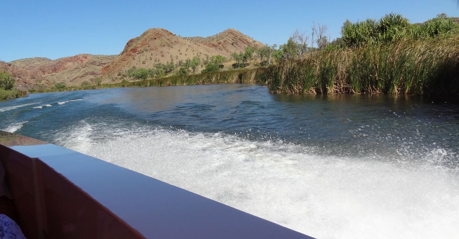
We took the opportunity to do a boat trip from the main dam, down the Ord River for 23km, until it hits the backwaters of the diversion dam, then turned around and returned to the dam. This is where our dilemma began.
Ultimately we decided that the Katherine and the Ord are, in their own way supreme equals. The Katherine Gorge is the epitome of serene tranquillity, where mirror smooth waters invoke calmness.  The Ord generates animalistic exhilaration and excitement as you hurtle through a twisting and turbulent rapid strewn rugged primeval and stunning landscape of spectacular high cliffs.
Gentle sections

Followed by more interesting sections

and all at exciting speeds
Of course the boat that we were on may have had some impact on our thoughts – it held 37 passengers, and had over 1000 horsepower pushing it down the river at 60kph. While the initial run down the river was great, the return trip against the river flow was a real adrenaline rush.
 It looks docile .... until it gets angry
What an interesting place is Kununurra. Where we expected to find somewhat flat or at best slightly undulating country, we found some stunning rugged ranges and gorges to the south.
It seems a wee bit odd to realise that the location of Kununurra was selected because of the vast alluvial plains that lay to the immediate north. This smooth endless flat land extends from the town, all the way to the coast and quite importantly as it drops only 42 metres in more than 200 km.
With Lake Argyle providing a totally reliable water supply, plus the enormous flat plain with a constant fall per km and you have the perfect components of the World’s largest gravity fed irrigation area.
Unfortunately, our greatest feral pest, the Cane Toad has found its way from Queensland, across Northern Territory and is now in West Oz. The first area it has got to is the above irrigation area, and it acts as if it has found heaven. To learn a bit about this pest, I went out one night to work with the ‘Toad Busters’ who catch (and exterminate) toads. It was a surprise to find that bare hands are the tool of choice – one young girl even used a technique of grabbing them by the snout! No fear of poison glands here.
The Toad Mobile - goes, or floats everywhere

Twelve kilometres downstream from Kununurra is Ivanhoe Crossing; another of those famous barramundi fishing spots that have achieved iconic status. Due to the floods and unusually late rains, the crossing has been closed to traffic for the last two years. However, this doesn’t stop those who seek the thrill of catching a really big fish. Interesting to note that last week, a few km upstream a 4+ metre croc was caught!
Note how deep and fast flowing it is - and big crocs live here!

Talking of crocs, (you like that little segue?), we did a 200km return day trip to Wyndham and found one of the best lookouts you could imagine (okay, that may be a bit of hyperbole, but it is really good). Wyndham faces onto the Cambridge Gulf, which in turn is fed by 5 rivers and thus the lookout is so called “Five Rivers”. It was a little disappointing to find that we had arrived at low tide, and with a tidal range of 10 metres, that is very low. The other thing the town has is a croc farm – they capture rogue beasts that are harassing various communities or towns and then breed from them. The young are ‘farmed’ at about 2 metres long (two to three years) and the entire output goes to France for use in high end products.


The Egg collector and his 'Cone of Silence' - waits until they open their mouth, stuffs this over their lower jaw, pushes like mad, hopes they don't break it before his off-sider gets the eggs from the nest.

Wyndham Port from the lookout
Panorama of the Wyndham Old town
The Shopping Centre (1900's style)

As we left Kununurra we were pleased that we had found another magic place with heaps to see. It would be easy to spend some extra time there, but hasten we must to Purnululu.
Sometimes you can't have too many spares.

Commonly known as the Bungle Bungles, this rather special place is firstly, quite difficult to get to, and secondly worth every moment (and many more) of discomfort. While it is possible to drive the 55 km of rough road in your own vehicle, it does involve some degree of risk as the road is almost entirely corrugated, and has many rough creek crossings, and is composed exclusively of twisty turns and twists. I chose to go via 4x4 tour bus. Given the rough road and the 6 km of walking, Shirl also decided not to risk her bad back.
Two hours of pounding in the bus brings you to the Cathedral Gorge – I’m sure that everyone remembers the Qantas advert with the kids singing “I Still Call Australia Home”. Two kilometres of soft sand and/or rocky gorge brings you into this place and your first impression is to utter a fundamental profanity; it is utterly breathtaking. Professional photographers have the equipment and skills needed to capture both the width and the enormous height of this chamber, but my efforts are significantly less.
Entrance to Cathedral Gorge
Panorama inside the Chamber - it rises over 75 metres above you - note the pure white sand floor.

The next assault on the visual senses is the overwhelming volume of the ‘bee hive’ rock formations. It is impossible to leave this huge area without feeling that you have seen something very special.
The Bee Hives go on forever. Easy to get lost in there.

Another 40 km pounding brings you to the northern section of Purnululu and the Echidna Chasm where the track is not the detested and difficult soft sand, but a rock and boulder strewn creek bed that has you longing for the sand. As you enter the chasm you discover that even the pro-photographers have their limits. None have captured the awesome towering height of the Echidna. It just goes up and ever upwards, curving such that direct access to the sun or sky is denied, and simultaneously narrows to shoulder width. A number of false ends appear – you think it ends, but then you find another path heading off at an angle, or that the large rocks seemingly blocking the way, can be overcome by a little judicious squirming. After 700 metres you finally reach the end ‘chapel’. I was so much in awe of this place that after exiting, I turned around and walked it again.
 I knew I'd regret that extra spoon of casserole last night.
 The Entrance
Getting a bit funny in here folks.

Upon leaving the Bungle Bungles there remains another 100 km of decreasing rocky terrain to Halls Creek where the country again resumes the flat grassed plains so typical of inland Australia. Fitzroy Crossing is, as you would expect, on the banks of the Fitzroy. This, the largest river in the far north is the life blood of the local cattle industry, but does have a very bad habit of flooding. A chart at the nearby Geike Gorge indicates that 12 of the last 13 years have witnessed a major flood. This explains why the caravan park had the office plus ablutions block and camp kitchen built on high man-made mounds – it looked somewhat funny, perhaps a like a lord peering down upon his minions.
The Mighty Fitzroy at the Crossing

Derby! What an evocative name. Famous for the jetty and the boab trees, it offers much more. As Derby sits at the western end of the legendary Gibb River Road, it isn’t surprising to find the streets of the town are dominated by very dirty 4x4 vehicles. If the volume of local panel beaters, 4x4 repair shops, and car parts suppliers, local business prospers in its proximity to this track.


Derby Jetty at a moderate high tide (9 metres) - they go to nearly 11 metres

Low tide

And Harry, our travelling Bear liked the jetty too.

The Prison Boab - all hollow inside.

The day before we left, we returned to our van to find four young cyclists who were kitted out for a long ride: we were amazed to find how long. These four guys, 1 German, 1 American, and 2 Pommies had left Darwin on 1 June and planned to ride around Australia by early December. One of them, Tommy (the pommy), had no history of cycling and had joined the others because of his artistic skills in recording the journey. But, in the first 30 days they had ridden through Kakadu to Katherine, then to Kununurra where they started 10 days of purgatory to ride the 660 kilometres Gibb River Road to Derby. Toward the end of the Gibb, Tommy had some frame breakage to his bike, and then his gear derailleur ceased working. With no local bike shop, they had little choice but to call on a couple who were beside our site, and that they had met at a campsite near Katherine. A plan quickly evolved with Karen and Ray taking the bike, and Shirl and I taking Tommy to Broome. The other guys left for Broome at 12:30.

This was our first sight of the intrepid pedallers.

The next morning we hit the road at 9:30 and expected to pass the bike riders fairly quickly, but as the km rolled on past the 150 mark we began to worry that we may have missed them at a rest stop or  ..... ?????  All worked out when we came across them at the 160 km mark (10:45 am). They had ridden heavily laden tour bikes 160 km: included was 95 km that day since 6:20am!

Along the road  - Tommy is in long pants.

A roadside energy stop where 3 litres of orange juice and a packet of Tim Tams were scoffed down soon had them ready for the remaining 60 odd km.

Their website is: http://www.lifeuphoria.com/, and to read their history is an eye opener.

These guys were the latest in a number of cyclists we have passed, and then re-passed as we have crossed the top end. Tommy was able to answer a question we had about one of these long distance tourers – a lone lady, obviously well past her youth has been on a similar timetable as us for a few weeks, and we wondered what the story is/was. Tommy explained that they had met Lizzie, and at 74 years old she has flown to Darwin each of the last 3 years, and then ridden back to Perth within 3 months. She is totally self sufficient, carrying all her needs on the bike.


Cable Beach at Broome - note the huge surf, NOT
We are now in Broome where we will spend a week before pushing down to Eighty Mile Beach for another week. Unfortunately, or perhaps the opposite, this place has no mobile access, no internet access, no email, and very poor TV: just a long and glorious remote beach at the end of a 10 km dirt track. We will be back in the world somewhere around mid July. If each of my loving sons wishes to remain in the Will, they'll record each day of the Tour d’France.